FL340
Alaska flight 7, now somewhere over western PA
Well, this is it - we're winging our way westward, on our way home from an epic adventure. Im writing this on the plane and don't have an easy way of transferring any pictures, so this is in boring plain text. Today, of course, the sun came out, and I didn't use the windshield wipers at all. Ah well, that's the way it goes, eh?
It was interesting and fun to be in the West Point area on the weekend of graduation. That's a big deal at any college, of course, but at a service academy, it's pretty special. We saw several families at our hotel who were there for graduation, accompanied by well-groomed young folk. I wish them all well, even if my own feelings about armed conflicts are, well, conflicted. I support a strong defense; I'm conflicted about unprovoked offense. Anyway.....
We were staying only about 12 miles from West Point, on the opposite side of the Hudson. After a breakfast of proper bagels, we set out across the Newburgh-Beacon bridge, then proceeded south on highway 9W. The road climbs up above the river, offering tantalizing peeks and vistas. At one point, I did catch sight of the academy, but wasn't in a position to pull over for a longer view. Oh well.
We exited the highway into Highland Falls, the "gateway" as it were to the academy. Had a little bit of confusion over the GPS vs. the signs off the highway, but we soon found the Visitors Center and Museum. Wondered if it would be open, but not to wonder - it most certainly was. All those families in town! And, lots of Asian tourists, too. We toured the exhibits in the center, which offered displays and explanation of USMA life. We also checked out the nearby museum, with its history of the US Army. Overheard a father, who was pointing out a sword from the 1800s, explaining to his daughter "that's like the sword of Gryffindor". Whatever makes it accessible, I guess!
It was pretty cool to get a glimpse of the USMA. I have family connections to the USAFA in Colorado Springs, so I've been there. And, I saw the Naval Academy as a kid. Again, whatever one's feelings about warfare, the military, etc, theres no denying the history of a place like West Point.
We got back on the road, headed eventually to Newark Airport. Highway 9W is a favorite of Bicyclists in these parts, and for good reason, It's a wide, winding highway, going up and down and through the trees. Being a fine Sunday afternoon, there were a lot of cyclists.
Stopped for lunch, and made it a quick one to get back to the airport, with time to gas up the car, etc. To expedite, we jumped onto the New Jersey Turnpike, and I got to experience using a Service Area - the gas station/rest area/fast food/pause in the road so you don't have to jump off and onto a toll road to get what you need. And, this was the Vince Lombardi service area, too. "Fueling isnt everything, its the only thing!". New Jersey has a mini-service law, which means someone else pumps your gas, and there were a lot of cars, trucks, motorcycles, etc, who all needed gas! We got out of there, and then it was a quick hop to EWR.
So now, reflection. I'm so grateful we could make this trip. I'm so grateful we travel well together! I was struck, continually, on how beautiful everything was - different from what I'm accustomed to, but still very pretty. We had but a taste of everywhere, and I would like to go back to just about everywhere. I look forward to spending more time someday. (And oh, the lobster!)
Some rough stats:
Miles traveled by car: roughly 4,300. (Really!!)
States visited: Eight
Provinces: three
Hotels: Fifteen
Airports
Visited: too many to remember now!
So, for now, thanks for reading, and thanks for coming along for the ride! From somewhere (now) over Wisconsin, this is Kit and Nancy, signing off.
Cheers,
Kit and Nancy
Sunday, May 26, 2013
Saturday, May 25, 2013
Hudson Valley Sampler

Today, we explored the mid-valley region of the Hudson River. This was one of the main reasons we flew into Newark - to be close enough to this area, too. As with the rest of this trip, we're only scratching the surface of what there is to see, and that's ok. Hopefully, we'll be back someday!
Today's weather report: breeeeeezy! The clouds came and went, the rain sputtered and splashed. The wind, though, well, it didn't hold back. Most of the day, we dodged tree branches and stuff in the road, and we even got nailed by a flying cardboard box. Given that there were three college graduations in the area today, I hope there were contingencies for weather!
We slept in (!) before setting off for the primary destinations of the day: Rhinebeck, and Hyde Park. Rhinebeck, for its wonderful old 'aerodrome', and Hyde Park, for the Franklin Delano Roosevelt home, library, and museum. We crept a bit along highway 9 northbound, caught in the Saturday traffic. We knew Vassar's graduation was today, and didn't want to get caught in that traffic, but found ourselves driving right by the campus! The ceremony was probably underway by then, though, as there wasn't any traffic to speak of. What a pretty campus, at least what we could see of it. Light gray stone all around, the buildings, the walls.
Took a detour to go look at Duchess County Airport, Poughkeepsie's main field. It looks impressive enough, with a control tower and three runways (one grass). Foreflight's assessment - "excellent asphalt. Good dirt". By taking this detour, we were able to slip up back roads to Rhinebeck, enjoying the countryside along the way.
 The Old Rhinebeck Aerodrome features living, breathing antique aircraft. It's been a goal to get there someday, and Nancy, especially, has been vigilant in ensuring we would see it. It's a pilot's and gear heads dream, with ancient aircraft, automobiles, and motorcycles. Some of the aircraft are replicas, but a lot of them are originals, lovingly restored. In the summer, the aerodrome hosts airshows, with mock dogfights ala WWII, and fly-bys of all sorts. In season, and in the right weather, they also offer biplane rides over the Hudson River. The runway, grass of course, is a big wide patch cut out of the trees. The museum is scattered out among several hangars around the grounds, and the hangars are also somewhat elderly, fittingly,
They haven't started the air shows yet, and the weather was too windy for a flight, even if they were on offer. Nancy and I had the displays to ourselves, though, and were able to geek out as we wandered through the hangars. Tree branches crashed and scraped along the hangars, which at first made me think somebody was working in there. But no, just the wind.
I'm not going to list the whole collection here - you can look at their website for that. It's impressive, though, and even more so because the aircraft (et al) look appropriately "seasoned," not sanitized.
We walked out to the airport, noticing the benches set up alongside the runway. Somebody needs to mow the grass before the show starts! We also observed some guys firing up one of the ancient fire trucks - I think they were allowed to do that?!
Got back to the office/gift shop to find the wind had knocked out the power! No problem, she was able to sell us our trinkets anyway :-)
 So, back on the road, this time in search of lunch. We stumbled upon the "Historic Village Diner" in Red Hook, NY. Our GPS called it the "Hysteric Diner". - that's how she says Historic. Ha! Anyway, one more diner experience, in a genuine old diner building.
Off to Hyde Park next, and FDR's place. (here's another link - this one to the National Park Service site.) By this time in the day, we knew we had time to explore the grounds, but probably not the house or Presidential Library. Nancy assured me that was OK, and we could always come back for the history geek tour. So, we set off to wander the grounds, dodging the odd flying branch or two.
 The grounds are quite extensive, and it's presented well for the visitor. There is, of course, a Visitor's Center, named for FDR's longtime VP, Henry Wallace. FDR's library is in its own building. And, the big draw is the Roosevelt home, Springwood, sitting high above the Hudson. Even from the outside, it's very impressive.
Franklin and Eleanor are buried at Springwood, in the Rose Garden there. It was rather moving to be there, quietly paying our respects with nobody else around.

I wish we'd had time to go to Eleanor's retreat nearby, Val-Kill, but alas, that'll have to wait for another trip.
My camera battery died at the FDR site, then Nancy's informed her the SD card was full. Guess that's the universe's way of saying it's time to come home!
We started back south to Fishkill, detouring for (wait for it....) another airport! This one, with the innocuous name of Sky Acres, but it's a charming, charming airport. Wish I could fly in here sometime! Nestled in the hills, built on the site of an old dairy farm, it's really quite picturesque. The taxiways look challenging (much up and down) and the runway drops off significantly past both thresholds. That's why there are displaced thresholds, no doubt.

We also did a quick drive-by of the Culinary Institute of America, the original (?) CIA. Quite an impressive campus! Alas, their student restaurants weren't open - probably just as well!!
We took a section of the pretty Taconic State Parkway south to Fishkill. A parkway, pretty? Yeah, this one, at least the part we saw, is downright pastoral.
Tonight, sorting and packing. Fortunately, I'm traveling with a pro in those categories :-) Tomorrow, we hope to catch a glimpse of West Point, as we make our way to EWR and our Alaska flight home.
cheers,
--Kit and Nancy
Friday, May 24, 2013
A trip down memory lane
 |
| Granddaughter of Hildegarde Ware Warfield, class of 1914 |
For Nancy, for real. For Kit, as proxy for her grandmother.
Today, we concentrated on western Massachusetts. We started the day in Northampton, with the same kind of weather we'd been having - cloudy, a bit misty, and not terribly inspiring. But, you gotta make do with what you get, so off we went with our raingear and good attitudes.
(I must interject something about yesterday, though - even though it was rainy & cloudy, it was also my humidity wakeup. It's been cooler and not too humid for most of our trip, but yesterday, I started feeling it. The air temp. was about 70 to 75F, but with the humidity, it felt much warmer, of course. Esp. to me. I admit it: I'm a warm-humid-weather-wimp! Today was much, much cooler, and therefore more comfortable to the likes of me!)
We stopped off at Northampton's Airport, the "home of Friendly Flying" according to its signs. Looks like a nice little airport. Then, into the center of the village to find a place to park, and explore Smith College. Northampton is a charming village, truly, with a less-than-modern street layout (I mean that in a good way.) And, as I wandered, I had a local on my tail. Now I know why they call 'em "Massholes" lol. We found a parking spot on a street just off campus without trouble, though.
Why a visit to Smith? My father's mother, Hildegarde Ware Warfield, graduated from Smith in 1914. Wouldn't you know that Smith was having an Alumnae weekend this weekend, too! We saw women of all ages (mostly older, though) walking around campus with their nametags, pointing out features, greeting each other, and so forth. It's a gorgeous campus, straight out of central casting for a New England college: old, pretty brick buildings laced in ivy, green expanses, tall, healthy trees. Understated signs for buildings, and no vehicles on campus. Except for the golf carts for workers, and the Alumnae Shuttle vans running around, that is. I don't think either of those were in use back in 1914!
We stopped by the library (of course,) then found the Campus Center and the book/T-shirt/etc. store. As we were shopping, I couldn't help but tell the woman helping us: "My grandmother graduated from Smith!" The woman nicely said "Are you here with her this weekend as her associate?" Um, no. She was the class of 1914 - Grammy Hilde passed away in 1975. But I'm sure she was there in spirit! The woman went on to say that she'd served as an associate for older alumnae on these campus visit weekends. "They need someone to run to the store for them. More hearing aid batteries, good chocolate, and scotch. That's what they usually need." Excellent!
Came away with some great Smith wear (both of us) and then had more of a wander around the campus. Lovely, lovely place. Was fun to play a bit of "what if I'd attended this college?" A Montana ranch kid on this genteel campus. Hmm.... :-)
We departed Northampton to the west, and started winding our way through the Berkshires, home to many a Gershenfeld family vacation. I know I've been writing this over the course of this whole trip, but this was yet another region of rolling rural greenery, small farms, winding roads. Green green green. And, even with low clouds hanging around, beautiful views, too.
We worked our way over to highway 20, and Richmond Pond, where the Gershenfelds used to rent a cabin in the summertime. Great setting right on the lake (sorry, pond). Nancy recognized it immediately, having enjoyed many a halcyon day there. I recognized it from the many pictures I've seen. Looks like they might be working on it - at any rate, nobody was home.
We stopped, then, for lunch in Lee, MA, at Friendly's, a chain that's probably very well known to children of all ages from these parts. For Nancy: lunch and nostalgia. For me: lunch and cultural understanding. Loved it!
After lunch, off to Tanglewood, the summer home of the Boston Symphony. Yes, it's kind of like Band Camp for the professionals: they get to go spend summer days in the country, practicing and performing in outdoor and semi-outdoor venues. And, music fans can take picnics and listen to wonderful music in a beautiful rural setting. This has been a favorite pastime of the Gershenfelds in years gone by, and although it's not open yet, we were able to explore the grounds. Lovely!
 |
| Nancy at Tanglewood |
At Tanglewood, we realized how much colder today was, compared to yesterday. It was about 48F there, and we experienced a few sprinkles of rain. Sigh. Oh well, back into the car, and off for NY State!
We crossed into New York and headed for the Hudson River, crossing it on the Rip Van Winkle Bridge to drive south on the western side of the river. The Hudson doesn't disappoint in presenting itself as one of America's mighty rivers. I was interested to see a number of industrial plants along the west shore, and, of course, shipping, too. It's a very broad river, at least where we were, and its bridges are impressive. (Couldn't help but think about those poor people on I-5 in Washington State, yesterday, though.....)
The various secondary highways along our route in NY today all are related to highway 9: 9G, 9F, 9H, etc. We spent most of the drive down the Hudson on highway 9W. Near Saugerties, I spotted a sign for a lighthouse, and in keeping with the spirit of this trip, turned left immediately to go check it out. Turns out we got a little walk through the woods and wetlands to see it - it's about a half-mile walk to get out to it, and it's available as a B&B if you're lucky enough to get your reservation in. It was quite windy along the water, the wind blowing downstream (south), but it was peaceful walking along, too. Great views of the river, even in the wind.

After that, back on the road after our walk, and south to the Newburgh-Beacon Bridge . (I know - all this talk of bridges is like Rimmer's collection of photographs of early 20th century telegraph poles #reddwarfgeek) Then, Fishkill, our last stop on our epic adventure. No, the town name does not refer to dead fish! It's from the Dutch, don't you know. Anyway, it's as close as we could get a hotel to where we want to do some exploring - Rhinebeck Aerodrome and Hyde Park. We didn't realize it until today, but there are three graduations this weekend: Vassar, Marist, and West Point. Consequently, every hotel room for 50 miles is booked, and there are lots of "Proud West Point Grandparent" bumper stickers around. No matter: we're comfortable, had a great Italian meal in a restaurant bustling with happy locals, and, even if it rains (it will) we'll have a good day tomorrow!
Hard to believe the trip is almost over. Lucky to have had such a great opportunity!
cheers,
--Kit and Nancy
Thursday, May 23, 2013
From White to Green Mountains
Thursday 23 May
Northampton, MA

Today, we explored the Green Mountain state, Vermont. We're gradually working our way back south and west, and wanted to be in western Mass. tonight, so we chose to get here by way of VT. There's a low pressure system that's pretty much stalled over all of New England, so the weather was pretty crummy all day. Make the most of it, though - that's what ya gotta do!
So, we started the day in Concord, NH, where we took a little detour out of town to see the airport (you knew that was coming, didn't you?). We then hit the interstate to scoot up to Lebanon/Hanover, NH, and the VT border. I was curious to see Dartmouth College, as we have some friends who went to school there. Also, we'd decided to spend most of the day in Vermont, so we took the 30-odd mile interstate route. That also gave us the opportunity to stop at a NH rest area, apparently sponsored by the state Dept. of Transportation - at least the vending machines!

(we did not avail ourselves of the opportunity)
It's gotta be one of the prettier drives on an Interstate highway, I-89. Straight through the woods, without a lot of anything else around. Once we drew nearer to Lebanon and Hanover, we discovered more hills, and of course, more people. But still, it's a wonderful setting for a college. We stopped by the campus to take it all in.
Then, onward to Vermont, and the back roads, yay! We exited I-89 for highway 4, and stopped at Quechee first. Besides having a kind of funny-sounding name, Quechee also offers up a beautiful gorge, in addition to a somewhat-kitchsy shopping village. We hit the shopping first - although, I confess, I'm not much of a shopper, there were a few Vermont things I wanted to take home, and might as well get it done early in the day. After that, we took a short hike in the Quechee State Park to view the bridge and beautiful, deep deep gorge.


Northampton, MA

just another day in Vermont
Today, we explored the Green Mountain state, Vermont. We're gradually working our way back south and west, and wanted to be in western Mass. tonight, so we chose to get here by way of VT. There's a low pressure system that's pretty much stalled over all of New England, so the weather was pretty crummy all day. Make the most of it, though - that's what ya gotta do!
So, we started the day in Concord, NH, where we took a little detour out of town to see the airport (you knew that was coming, didn't you?). We then hit the interstate to scoot up to Lebanon/Hanover, NH, and the VT border. I was curious to see Dartmouth College, as we have some friends who went to school there. Also, we'd decided to spend most of the day in Vermont, so we took the 30-odd mile interstate route. That also gave us the opportunity to stop at a NH rest area, apparently sponsored by the state Dept. of Transportation - at least the vending machines!
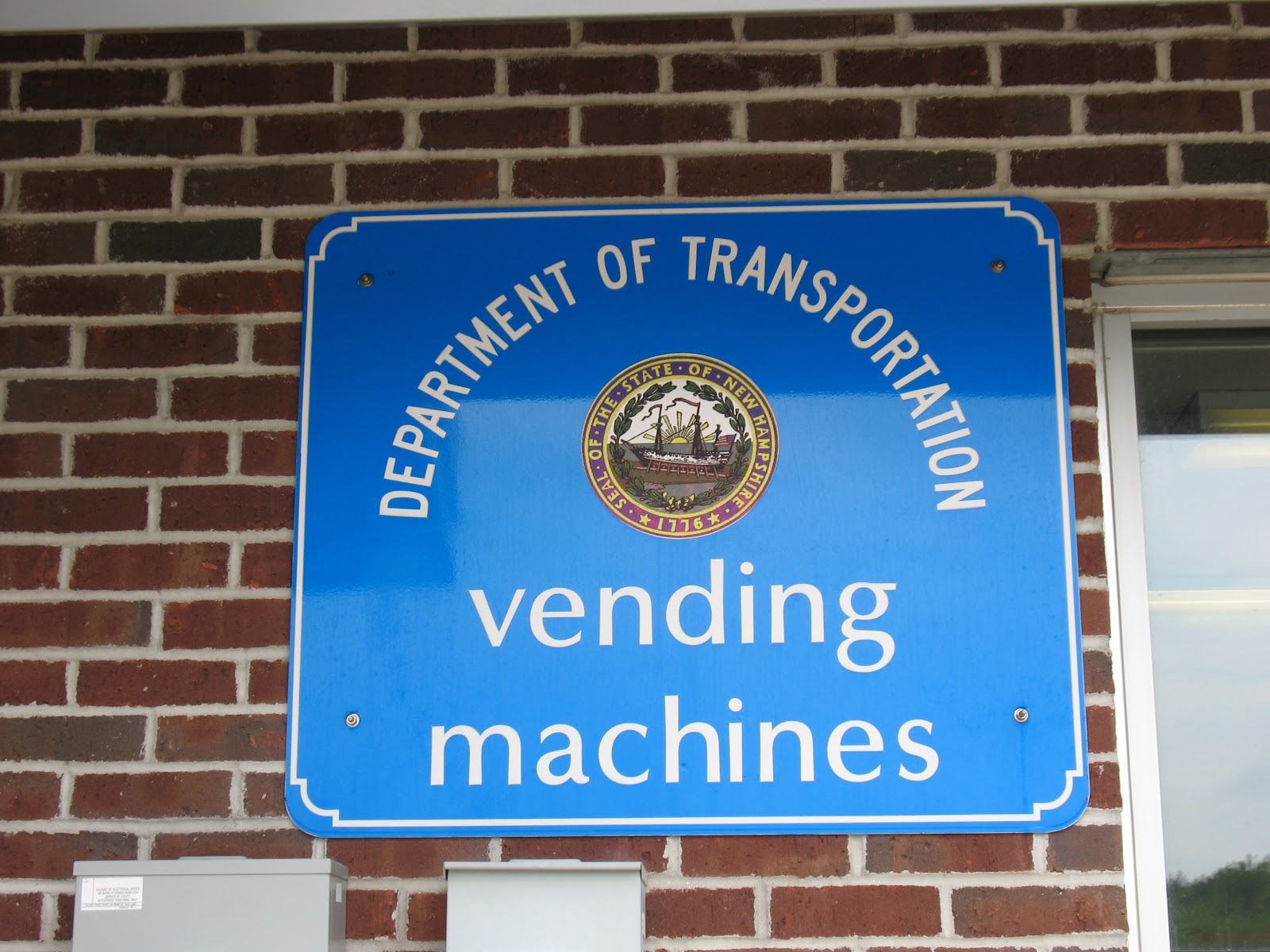
(we did not avail ourselves of the opportunity)
It's gotta be one of the prettier drives on an Interstate highway, I-89. Straight through the woods, without a lot of anything else around. Once we drew nearer to Lebanon and Hanover, we discovered more hills, and of course, more people. But still, it's a wonderful setting for a college. We stopped by the campus to take it all in.
Then, onward to Vermont, and the back roads, yay! We exited I-89 for highway 4, and stopped at Quechee first. Besides having a kind of funny-sounding name, Quechee also offers up a beautiful gorge, in addition to a somewhat-kitchsy shopping village. We hit the shopping first - although, I confess, I'm not much of a shopper, there were a few Vermont things I wanted to take home, and might as well get it done early in the day. After that, we took a short hike in the Quechee State Park to view the bridge and beautiful, deep deep gorge.

Quechee Gorge - the Grand Canyon of Vermont
Something I like a lot about both Maine and Vermont: no billboards. I didn't realize before this trip that these states banned billboards, but I noticed once we got into these states. Prince Edward Island, too. There are just tasteful little signs directing you to various businesses in the towns. It makes it easier to enjoy the fantastic scenery.
And oh, does Vermont deliver on that front. It's aptly named: the Green Mountain state. And, I appreciated it most from the backroads. We wound along the Ottauquechee River, up and down and around the bends. Farms here and there, but mostly, just trees and water.
Saw a covered bridge being either replaced, or at least seriously overhauled:

We stopped for lunch in Woodstock, a charming town that's known for being one of the more "tony" spots to call home, or second home, or fourth, or whatever. It's very pretty, though. We ate in a little coffee shop on the main street, in a colonial building (well, they're all colonial, or look like it anyway!) Once inside, however, it showed itself to be a friendly, hometown joint, not a twee teahouse for tourists. That's nice.
Got a look at Woodstock's impressive library building, too. Here, inspected by Our Own Librarian:

From Woodstock, we continued on highway 4, driving through the heart of Calvin Coolidge country. Did you know Calvin Coolidge was from Vermont? I think I remember that bit. I also remember that he was Warren G Harding's vice president, and became President only when Harding succumbed to an early demise. What I didn't know was that when Harding died, Calvin was up in Vermont helping his father with the haying. As it was the middle of the night, and they were in rural Vermont, he was sworn in by his father, and then Calvin went back to bed for the night. We seem to be on an accidental Calvin tour today, too, because we're staying in Northampton, Mass, which has its share of Coolidge history. And, Henri, Le Chat Noir had a Coolidge quote today, too. Hmm....
Anyway, we didn't actually stop at the Coolidge farm, nor visit Silent Cal's grave nearby. We kept on through the gorgeous countryside, which the sun was actually visiting, finally. Lots of green, both as grass and as trees.
In the tiny town of Weston, we stopped at the Vermont Country Store. As "flagship" stores go, this has got to be one of the prettiest, and most low-key. We've been patronizing their Web store for years, as they have good merchandise, and lots of fun stuff, too. The store comprises a series of older buildings (or they look old, at least) to keep with the General Store vibe. Check out their web site - they do have good stuff!
We'd bypassed the turnoff for Killington, et al, earlier in the day, and we'd passed by several of Vermont's other ski areas, too. Near Dover, we started to pass Mt Snow, too, but we ended up swinging by anyway. Nancy's parents used to take a ski week there, and we wanted to check it out for ourselves. Looks lovely, although pretty quiet this time of year. (by the way, we skiied Killington with Nancy's parents several years ago. Were asked more than once on the chairlift: "Seattle, huh? Do you know you flew over the Rockies to get here?!")
Pretty soon, it was just us on the road, as we climbed up and wandered down the many hills. Our car, the Dodge Avenger, has served us very well on the trip, but it's clear - it's not a mountain car! It huffs and puffs up over the ridges, eventually making it

Our chariot
We finally said Goodbye (for now) to Vermont, and entered Massachusetts on highway 112. Nice and rural crossing, and we're back in the Commonwealth after two weeks away. By this time, it'd started to rain pretty heavily, and we high-tailed it over to I-91 to take the faster route to Northampton. I had the wipers going at full speed, and it still wasn't enough (almost.) It was a relief to get to our hotel for the night, which the GPS calls "Hampton Inn and Suites Hadley AmheRrRrRrRst"
Tomorrow - exploration of Smith College, my grandmother's alma mater (99 years ago!!). Then, off through western Mass., heading for NY and the Hudson Valley.
cheers,
--Kit and Nancy
Wednesday, May 22, 2013
White Mountains

White? These mountains look green to me!
Weds 22 May
Concord, NH
We spent today wandering through central New Hampshire, and the beautiful, peaceful White Mountains. I say "peaceful", because (I say yet again!) it's great to be here in the off-season, or at least at the very, very beginning of the season. It's obvious that the White Mtns area is equipped to handle massive crowds, and, indeed, our "Driving New England" book says that it's the second-most visited natural area in the country. Great Smoky Mtns National Park is #1.
Started the day by checking out of our hotel, after a meet & greet with the motel's sweet, sweet pit bull cross, Pumpkin. All lodgings should have canine ambassadors :-). Next, breakfast and coffee at Dunkin' Donuts (hey, don't judge: we had egg sandwiches, promise!). I bring it up only because we got to observe some fun things: the taciturn (cranky?). New Hampshireite who took our order, and the locals, inc. a cop, having a spontaneous gab fest in the parking lot! Ah, small towns....
Gorham features a railroad museum, with a fine collection of rolling stock, and a couple of cool engines. It's also situated right next to the town library, which delighted us. Our friends Meredith and Travis must visit here - she's a librarian, and he's a train enthusiast! Oh, and pilot too. :-). The library is a beautiful classic building with lovely old rooms. Were amused, though, when we walked in and were asked "Are you here for the AARP event?" haha

So, no matter that the clouds were once again really low today - low enough that we could not see the tops of the mountains around Gorham. And, driving up Mt. Washington, as much as I wanted to do it, wasn't in the cards today, either. We wouldn't have seen any of the fantastic scenic vistas on the way up, and the weather up top was 0/0. In fact, for my pilot & weather-geek friends, here's some of the METAR from about 1400Z: 340/24G52 0SM VV000 08/08.
The drive we did take, though, was beautiful. We headed south on highway 16, cutting through the heart of the White Mountains National Forest. More warnings about moose on the road ("HUNDREDS OF COLLISIONS" sayeth the signs), but today, no moose along the way. We saw a few fellow humans, but not too many (see comment, above.)
And what we did see in great bounty: trees, trees, trees. Evergreens, decidious trees, all together. Since we were traveling through a National Forest, there were few signs of human intervention. Just scenic pullouts along the Swift River, and a few campgrounds. And, lots of trailheads. Lots of opportunity to explore the backwoods! We stuck to some walkways near the road, but did get down near the river a few times. The Swift is full of boulders, large and small, at least at the viewpoints we visited. (in fact, one is called "Rocky Point") Some of the boulders had rock cairns on top of them - somebody hiked out there to leave a calling card, I guess. It was gorgeous, peaceful, and green green green.
We saw a couple of covered bridges along the way, too! These were my very first covered bridges, and I liked them a lot. Nancy also said "OK, my day is complete" after the first one. Here they are:


At Conway, we turned west along highway 112, to climb up over Kancamagus Pass. Now, here's m opportunity to tell you all that I love mountains, no matter how big or small. I'm not so much of a mountain snob to say they have to be over 8,000 ft. tall to be called mountains, or whatever. So, case in point: the White Mountains aren't that tall, by Rocky Mtn. standards, at least. And Kancamagus Pass is only 3,763 ft. But, it's an impressive climb, and fantastic views from both sides, east and west. Lovely.
We stopped for lunch in Lincoln, near Loon Mountain Ski Area. Then, we picked up I-93 to scoot south to Lake Winnipesaukee, next up on the scenic hit parade! We exited I-93 at New Hampton, and drove to Meredith, NH. Remember earlier in this blog when I talked about our friend Meredith the librarian? How about visiting the Meredith Library?! Which is housed in yet another beautiful old building, and which was getting its spring garden put in today, too. We explored this library for a bit before heading back out.

We just missed the aviation talk at the Meredith Library! It was last night
What, no airports today? Funny you should ask - we visited the Moultonborough Airport shortly after Meredith. Small, very unpretentious place, with a cute little pilot clubhouse. And, we were very amused by our GPS's pronounciation of the name. She (our GPS - we call her Maggie, because she has an English voice and she's bossy) can't pronounce the letter R very cleanly, for some reason. It comes out all warbly and funny. So, lots of amusement with words such as AiRRRRport, or whaRRRRRf, and so forth!
Lake Winnipesaukee is big - really big. We took the side roads to go around the east shore, and were able to catch glimpses here and there. There is at least one seaplane operator on the lake, but it appears they're not quite open for business yet, because we didn't find them. We did check out one of the beaches, though, and even in the low clouds, it was inviting....
Decided to head for Concord for the night, as we want to be in western Mass. tomorrow night, by way of Vermont, so it seemed like a reasonable choice. Besides, I like state capitals - my dad was in the Montana State Legislature, and so I grew up visiting capitol buildings. Found a Best Western, and found a place for dinner downtown, right across the street from the Capitol building itself. Had dinner in a "gastropub" that has seen its share of visiting politicians - remember that New Hampshire has the early presidential primary, after all.
Tomorrow - as mentioned - off to the west to Vermont, then down into western Mass. Hard to believe we have just a few days left on the road, but it's ok. We've both had our moments of forgetting which hotel room is ours, since we're in a different one just about every night. It'll be nice to cook homecooked meals again. And, all the other benefits of being home, not least being beholden to our cat, Amelia, again! But it's sure been fun to be out exploring, and it's not quite over yet.
Cheers,
--Kit and Nancy
Tuesday, May 21, 2013
Moose!!

I'm just a moose, and I'm doin' moose stuff.... What?!
Tuesday 21 May
Gorham, NH
After all the warnings along the various roads we've travelled, we finally saw a real, live moose today! Just munching by the roadside, Maine state highway 16, west of Rangeley. I like to think that growing up in the Rockies, and making frequent trips to Yellowstone NP, heightened my awareness of potential roadkill - as in, "look for the animals, and don't hit them!" This guy was just hanging out.
So, today, we coped with rain and low ceilings (clouds, that is.) It prevented me from flying at Twichell's :-( but I did get to chat with Dale Twitchell, and his fabulous, genuine Maine accent :-) And, we got to go exploring the seaplane base side of 3B5, also known as Twitchell Airport. Lots of folks own airplanes in Central Maine, and during the liquid (i.e. not frozen) months, they like to put floats on those planes. We saw lots and lots of floats awaiting their summer installation. We also saw a Cessna 150 on floats! I would have thought such a thing wasn't possible, haha.


What these photos don't show is the 400-ft ceiling, and the 2 to 3 miles visibility. Not exactly conducive to lake hopping and sightseeing! So, I promised Dale I'd be back sometime. Flying's like that.
We took backroads all through today - from our hotel in Bangor to the Bangor airport itself, then winding through central Maine. Thanks to the relentless rain and the low clouds and mist, we didn't see sweeping vistas, but it was pretty nonetheless. It didn't stop our GPS from randomly announcing things like "Continue on Lovely Lane for ten miles" And here we thought we were on highway 133! (or whatever).
We also came upon a number of libraries and small airports, big surprise, I know. Here's one of the libraries, from Canton, Maine

After Twitchell's and Turner, ME, we decided to swing up to the north to the Rangeley Lakes area. This is a part of Maine I've always wanted to visit - numerous lakes, pretty mountains, you get the picture. Well, we enjoyed our visit, even though we didn't exactly "get the picture" thanks to the weather! We enjoyed a little picnic on Rangeley Lake, where we also saw another seaplane operator, Acadian Seaplanes. Nobody around, but at least the plane was on the water.
We were booked for tonight in a motel in Gorham, New Hampshire, so we left Rangeley and started west. That's when we saw our friend Bullwinkle! And more signs telling us to watch out for moose. One sign was pretty shot up in the hind legs - funny, in Montana, that same sign would have shots through the butt of the moose!

What, aiming at the right rear hoof or something?
Gorham is the jumping-off point for the White Mountains, and the whole drive from Rangeley to here was just stunning. It's a small town, but with plenty of amenities for travellers. Had a nice dinner, and now back to our room in a renovated old-style motor lodge. Hey, it's got free WiFi, right? (actually, it's quite nice.)
Tomorrow? Well, if the weather is cooperative, we plan on ascending Mt. Washington. (yes, by car!) The Wx, though, doesn't look terribly appealing, so we might give it a miss this visit. Given that Mt. Washington is famous for having "the world's worst weather," we'll just have to see. So, some or all of the day will be spent exploring some of New Hampshire, and/or maybe some of Vermont, too. It's all good.
cheers,
--Kit and Nancy
Monday, May 20, 2013
Le parcours à travers les arbres

Confederation Bridge, PEI
20 May
Bangor, Maine
Today was a travel day: we drove farther than on any other single day of the trip: over 400 miles. That was by design, to get us back down to the States and to some things we want to do before heading home to Seattle this weekend. So, we buckled up and hit the road south.
Before checking out of the hotel in Charlottetown, we had breakfast, and observed how.... Canadian the other guests were. I think they were all there for the hockey tournament, and we saw boys playing spontaneous games of street hockey out in the parking lot. And, there were orderly queues in the breakfast room. And then, best of all, on the morning TV news/variety show, we saw a CBC interview with the Seattle creator of "Henri, Le Chat Noir."
But first, some last wandering on PEI, on the way to the Bridge. We stopped at the Cows visitor center, taking the requisite silly pictures. We took part of the Scenic Red Sands drive, which offered up more great views of the farmland, the ocean, and some glimpses back to Charlottetown, too. We discovered Port-la-Joye–Fort Amherst National Historic Site, which offered history, lighthouses, and great views all in one - and no other people around!! Hard to beat that.
At one point, on the back road upon which we were travelling, we came across a orange tabbycat sitting proudly in the middle of the road. Kitty didn't budge - she meowed as we crept by, as if to say 'Hey! this is MY road! You'll go around me!' There were kids nearby who were watching, and we think the kitty knows that road pretty well. Hope so. Later in the day, we also observed a mother duck steering her ducklings off the highway.
So, soon enough, we were at the Confederation Bridge, and heading south. I've mentioned this bridge before - it is one of those engineering marvels, and we, being bridge geeks, were excited to travel across it. It's a pretty design, and we had an easy crossing, esp. at the 80 kmh speed limit. I wondered what it was like for people who had lived on the island all their lives, forever tied to the ferry to get off/on the island, and what it was like to suddenly have 24/7 access without fuss. It was a contentious decision to build the bridge, but it seems that 15 years on, it was the right decision to build it, and link PEI to the mainland.
Once we were back in New Brunswick, it was time for some driving. We had lunch in Moncton, missing the opportunity to observe the tidal bore, though. Some other time, maybe? Then, we headed south on Trans Canada highway 2, and for the next few hours, we saw nothing but trees. Seriously. The immaculate four-lane highway wound through forest, and we saw nothing but trees and the road. No houses, no farms, no power lines. It was fascinating. And, wet. We drove into the rain, and it didn't let up for several hours. In fact, given the trees, the rain, and the position of the road, we missed out seeing New Brunswick's capital, Fredericton, altogether!
Oh, there was something we saw: signs cautioning us to watch for moose. Most of the signs were triangular, with a moose silhouette and the word ATTENTION! We did not get a picture of that sign, alas, but we did get this one:

We crossed the border at Houlton, Maine, and joined Interstate 95. Back to miles instead of kilometers, speed limit 75 mph, rather than 110 kph, and an easy ride on into Bangor, our stop for the night. About a half-hour out of Bangor, the sun came out. Perfect.
Why Bangor? It's a good stopping point for the evening, and it's a place we wanted to visit anyway. It has a famous airport, you see. KBGR has been a jumping-off point for crossing the pond, also a Welcome Home for many US service members returning from the Middle East. It was a refuge on Sept 11, 2001, and the days following, for a number of diverted ommercial flights. And, Nancy and I actually made an impromptu visit to KBGR last summer, on our way home from Scandinavia! Not our doing: it was a combo of bad weather at Newark (our destination) and the SAS A330 needing extra fuel after a lengthy holding pattern. We didn't get to get off the plane or anything, but I did think "hey, I'm in Maine!" Tomorrow, we'll visit the airport on our own terms. :-)
We went out for one more seafood dinner, at a place called McLaughlins. Their restaurant is a quiet little place down on the Penobscot River. On a tranquil evening, it was just right. I ordered my lobster "lazy style" tonight, and enjoyed the side order of sauteed fiddleheads, too. Nancy enjoyed shrimp.
Tomorrow - off to Turner, Maine, and Twichell's Seaplane Base! It's one of the better-known outfits in the country, and we're looking forward to checking it out. Then, on to the White Mountains of New Hampshire!
Cheers,
--Kit and Nancy
Sunday, May 19, 2013
Green Island, Red Island, Gentle Island

Anne of Green Gables? Naw, that's Nancy
Sunday 19 May
Charlottetown, PEI
What a difference a day makes! The weather today was stunning - sunny, calm, and much warmer than yesterday. We were really glad about that, because we really had only today to explore beautiful Prince Edward Island, and it's so much nicer when it isn't raining or snowing. Mind you, it was still a touch on the chilly side. But everywhere we went on the island, we saw people mowing their lawns, and the walk-up hamburger joints were busy.
PEI is surprisingly big. It would be a long day to try to see it all in one go, just driving around the perimeter. We didn't want to do that, so we chose a couple of areas in which to wander, and concentrated on that. After a breakfast of Canadian champions at Tim Horton's, we set off to the north. Charlottetown is situated on the southern side, about mid-island. We wanted to see the airport (of course!) and meander on up to the northern side, and Cavendish, of "Anne of Green Gables" fame.
(A side note: I must be one of the few who hasn't read the books, or seen the TV show or movie(s?) about PEI's most famous fictitious person. Certainly, I've heard about the stories, and have a vague idea about what it's all about. Fortunately, I travel with a very well-read librarian, who can give me the "Cliff's Notes" version, so I can appreciate what I'm seeing. Also, now I'll go read the stories - they sound delightful.)
PEI is very agricultural, as evidenced by the many, many farms and fields everywhere. The soil is a wonderful deep red color, owing to the high concentration of iron oxide. It makes such a beautiful contrast: bright green fields interspersed with rich red. Mostly, it's potatoes and grain, but there's a lot of hay being grown, too. Lots of dairy farms. (Canada's famous ice cream & cow-pun company, Cows, is based here in PEI) Lots of tractors and equipment! We saw the John Deere dealer outside the town of Summerside, and it was bursting with tractors, lawn tractors, equipment of all kinds.

Unfortunately, this doesn't come close to showing the deep red color. But maybe you get the idea
We actually got a little off-track trying to find our way, believe it or not. PEI does a good job of labeling its three primary tourist routes, and we had plenty of maps, GPS, etc. No worries - it's kind of fun to just explore, anyway!
We did follow the signs for the Green Gables route, and that got us up to the northern shore. Explored a beach near Rustico Harbour, including its lighthouse. Then, off to Cavendish and the Green Gables National Park.
As you can imagine, you can't really turn around on this island without running into something "Anne" themed. It's impressive to consider what a contribution it makes to PEI's economy, the tourism alone. Whole tours flock to Cavendish, there's a Green Gables Golf Course just next door, there are "Anne" shops in Charlottetown, not to mention the plays, books, etc. etc.
Anyway, today, the site was open on the outside, but not on the inside: the interior of the house, the visitor's center, the people dressed up in costume - that all happens later in the season. We were able to explore the grounds pretty much by ourselves, which was just dandy. We also took a peaceful walk along a trail set out through the woods. That was nice.
After all that, we started to head for the West Coastal Drive, which took us past the only other airport on the island (surprise, surprise!) What was a surprise, though, was finding a collection of three Canadian Air Force planes on display, in a memorial park! And, to top it off, a glider spiralling above. Couldn't have planned it better!

Hey, I could take this home! Well, maybe not...
The drive on the southwest side of the island took us into Acadian country, with French place names, lots of Catholic churches, and beautiful sweeping vistas down to the sea. Oh, and somebody with a driveway painted as a runway!

We worked our way gradually back towards Charlottetown, observing that in the area of several rural churches, there are signs cautioning about heavy church traffic. In both English and French, of course.
Back in C-town, we ate dinner down along the waterfront - I wanted one more lobster dinner :-) We had a friendly waiter, and we think he's a French-speaking native of PEI. Anyway, in the dining room, we were in the minority as native English speakers: there was a family from Quebec (?), a group of Japanese people, and more. Fun!
Beautiful, soft light as the sun set, as we watched two guys and a yellow Labrador get in their power boat and cruise away. And watched the light change over quiet Charlottetown.
The hockey tournament's over, so the hotel should be quieter tonight. Tomorrow, we turn south and west, and will continue in those directions for the rest of the trip. We'll cross the Confederation Bridge, shoot across New Brunswick, and aim for Bangor, Maine.
Cheers,
--Kit and Nancy
Saturday, May 18, 2013
Snow, Canada

From the "Cabot Trail," Cape Breton Island
Saturday 18 May
Charlottetown, PEI
It's not sticking or anything, but it did snow today. And, it might snow tonight. It was quite a chilly day, with temperatures hovering around freezing, and a biting wind. Neither one of us planned this trip for quite such extremes, and we've both acquired new sweatshirts and new jackets along the way!
But, we had a great day, despite the weather. We started the day in Sydney, in the rain and low cloud. Given that the forward visibility wasn't great, and also given that we wanted to make the Prince Edward Island ferry later in the afternoon, we opted not to swing out around the entire peninsula. We did take secondary roads, however, and the clouds lifted enough a little later for us to see more than just a few hundred meters.
As I've mentioned before, Nova Scotia does a great job of directing its visitors along interesting, themed pathways. Today, we followed part of the Cabot Trail, and then joined up with the Ceilidh Trail. We wound through the central part of the island, saying hello to Bras d'Or Lake yet again. When we got to the west coast of Cape Breton, we said hello to the Atlantic, and to the Ceilidh Trail. Alas, no music or dancing along the Ceilidh Trail -- this visit, anyway.
Part of the Cabot Trail involved a shortcut on a cable ferry - instead of taking the long route around by land, we opted for the 5-minute hop across an inlet of the lake. The cable ferry holds probably about seven to ten cars, max, and is connected to a cable - yeah, I'm smart that way, I figured that out! The ferry just slides back & forth on the cable, moving cars, etc. over.
Observation about the small towns, villages, and wide spots in the road of Nova Scotia: they all have a car repair shop. It might be the only business in town (literally) but it's there.
We picked up some goodies for lunch at a local co-op, and parked at Margaree Harbour for our picnic. It was really windy, and frosty-cold, too, although we were able to get a few pictures. There were fishing boats coming back in, and the conditions were impressive enough that the locals were watching them, too. The local postman was heard to remark "(effing) nasty oout there, eh?"

We crossed the causeway back onto the mainland of Nova Scotia, and bid farewell to Cape Breton Island. We backtracked yesterday's route a bit to get to the PEI ferry, which leaves from Caribou, near Pictou. And, as we drove along, we drove through some snow flurries.
There are two ways to get to PEI by car: ferry, or bridge. They're clever - you pay nothing to travel to the island, but you pay to get off the island. Consequently, we couldn't reserve a spot on the ferry; we had to do it Washington-State-style and drive up, first come, first served. It's a holiday weekend here in Canada, so we didn't want to take any chances on missing the ferry. Logistically, we wanted the ferry onto the island, and then the bridge off.
Anyway, we got to the ferry terminal a good 1.5 hours ahead of time, and had no problems at all. The ferry didn't fill up, in fact, it was probably only about 1/3 full. And, we had time to wait for a bit in the terminal building, which meant we discovered another branch of the Nova Scotia library system: a take-a-book-leave-a-book lending library! In Halifax, we found a library return box that was good for all libraries in Nova Scotia. Clever. And then here, they're encouraging people to share their books. Cool!
We ran into a young family in the terminal who'd stayed in the same hotel where we'd stayed in Sydney. They, too, were obviously heading for PEI. They're American, but have been living in NS for about two years, and are soon headed back to the States. They were extremely friendly, and the three children very well behaved! Mom got a little green on the ferry crossing to PEI, but then again, it was a little rough in parts!
This ferry, the Princess Island, is the smaller boat they use for the 75-minute crossing. It's also an open-hulled boat, similiar to our WA State ferries. They kick you out of our car for the crossing, though, so we set up camp upstairs. I did my usual exploring, nearly freezing out on the deck in the wind! Although we couldn't see very much because of the weather, it still was a neat crossing. It snowed a bit on the crossing, too.
PEI is Canada's smallest province, comprising just the island. It calls itself "The Gentle Island," and the license plates say "Canada's Greenest Province." It certainly sells itself well on first glance - we drove through idyllic farmland, green with red, red soil freshly tilled. Large farmhouses, tidy yards. Little inlets of the Atlantic here and there.
Charlottetown will be a joy to discover - we got in just at dark, and will have to explore tomorrow. Of course, PEI is most famous for "Anne of Green Gables," and there is a whole industry based on the stories. Most of the attractions aren't open yet, but we'll be able to see the village, at least. It's all good.
Holiday weekend in Canada means something else too: hockey tournaments. Apparently, there's at least one in town this weekend, and there are several teams (and their families) staying in our hotel. I think we're in for a noisy night.... but at least we don't have to get up super early tomorrow!
Cheers,
--Kit and Nancy
Friday, May 17, 2013
Fiddling around on Cape Breton Island

My, what a big fiddle!
Friday 17 May
Sydney, Cape Breton Island, NS
We're here tonight in Sydney, the unofficial capital of Cape Breton Island, at the northern tip of Nova Scotia. We took a fairly direct route from Halifax so that we could get up here and explore the town a little bit. Original plan had been to wander up the east coast of NS, but it looked like that would take many more hours than we had time/energy for. So, we opted for the "motorway" route, for the most part. It still took about 5.5 hours. See my comment, yesterday, about how Nova Scotia is bigger than I thought!
It rained last night in Halifax, but was sunny in the morning. The hotel appeared packed, at least the breakfast room did! It is the start of a Canadian holiday weekend -- Victoria Day -- and some families are getting a head start. We did get to meet the resident dog, Cocoa, before breakfast. She is tolerant of all the attention, but somewhat indifferent to it also. :-)
Our route took us across the center (centre!) of NS, then up the west side a bit, and then back across to the N-NE. The route happened to go by the Halifax airport, and we saw some commercial traffic coming and going. Landscape mostly rolling hills, evergreens, and deciduous trees, much like what we've seen in the other parts of the province.
We saw signs to a town with a fun name, Stewiacke, which touted its location on the 45th parallel. If you grew up where I did, just north of the north entrance to Yellowstone National Park, you know that means you're halfway between the Equator and North Pole. Had to stop there to get a picture...

Back on the road, and up through New Glasgow (!) and Antigonish, where we noticed the street signs became bilingual again. Not French/English, though - Gaelic/English. Here's where the "New Scotland" part really comes into play!
We crossed over the Canso Causeway onto Cape Breton Island proper, and took a secondary road to get to Sydney. In the center of the island lies a huge lake, Bras d'Or. It's about twice as big as Flathead Lake, which is my point of reference when it comes to big lakes. There are quite a few nice roads all around its various coves and bays, and we enjoyed winding around them.
As we neared Sydney, we passed Ben Eoin, a ski area by winter, golf course by spring/summer. It looks picturesque, with a nice view of the lake. Not a lot of "vertical," but a pretty setting.
Cape Breton Island is a major location when it comes to Acadian music, the North American flavor (flavour) of Celtic folk. That explains the giant fiddle along Sydney's waterfront! There are ceilidhs pretty much every weekend, and music around town. We ate dinner at the Governors Pub and Eatery, which has live music going most of the time, and is part of the province-wide "Taste of Nova Scotia." They're very locavore in their menu, which is cool.
The fog started rolling in during dinner, and we had to pick our way back up the hill to the hotel. It's lifted now, though. The forecast this weekend, though, does call for some snow, both here and on Prince Edward Island, our next stop. Probably nothing will stick, but it's going to be cold, nonetheless!
We're staying in a fairly new Hampton Inn, located on the hill above Sydney's downtown. It's also located in the Membertou First Nations neighborhood (It doesn't appear to be a separate Reserve, as such). So, traffic signs up here on the hill are also bilingual (or monolingual!), but this time, in Mi’kmaw.

Cool.
I'm sure I'm forgetting something, as always, but that's it for now!
cheers,
--Kit and Nancy
Thursday, May 16, 2013
Lighthouse Route

"Peggy," of Peggy's Cove. Oh, and Nancy, too.
Thursday 16 May
Halifax, Nova Scotia
Today, we based out of Halifax, and hit the road down the South Shore of Nova Scotia along the "Lighthouse Route." There are quite a few of them scattered along the South Shore (and elsewhere in NS, too), and the tourism board created a driving route for viewing them. Actually, there are driving routes for just about everything here on Nova Scotia: lighthouses, ceilidhs, farms, anything that might be of interest. It's a great place to be a tourist!
The day started quite wet & misty, with steady rain. Not really the best for spectacular ocean vistas, but this is the day we allotted for this activity, so let's go! The road, a secondary provincial highway, wound through some residential and semi-rural neighborhoods, before entering the Peggy's Cove area. The landscape changes to a mix of ice-age boulders, scrubby bushes, and rounded, polished granite. It's fascinating. Peggy's Cove sits in St. Margaret's Bay. You can read more about it by clicking the link. Anyway, the lighthouse, which the locals call "Peggy," looks as though it's growing out of the rock. It's a charming place, even in the rain. And, actually, especially in the rain, perhaps, because if the size of the car park is anything to go on, it gets very busy here in the summer. I liked it a lot, though, and the little village reminded me of Scotland.
Off down the road we went, where shortly we noticed a small sign for the "Swissair Flight 111 Memorial Site." We pulled in there, to join just one other vehicle, a minivan emptying out a family. The mom cheerfully handled the fact that it was raining and cold, and perhaps their day out wasn't going to be as nice as they'd planned. Kind of like us.
Swissair Flight 111 crashed in early September 1998 just off Nova Scotia, and all aboard perished. The memorial is actually in two parts: this first part near Peggy's Cove, and the second across the bay at Bayswater. The names and the remains are at Bayswater; the Peggy's Cove part acknowledges the loss, and thanks the locals who helped in the tragedy. It's moving to see, especially in the rain and mist.
Back on the road, winding down around through the various bays and coves. We saw plenty of lobster traps ready to be taken out to the water - the Canadian lobstermen have been in a mini-protest of sorts this week, over low prices for their catches. They've agreed to to back to the waters, at least in NS and NB. We'll see about PEI.
We stopped for lunch in Chester, a pretty little town, but with no place to park! We found a little place out near the highway, though - a hockey-themed pub. Of course.
We drove through Mahone, and saw its many little islands and also its famous three churches, all lined up. In fact, there are lots of churches here in Nova Scotia, apparently! Mahone also has pretty Victorian houses along the waterfront.
Down the road a bit more, we came upon Lunenberg, which is something else altogether - I mean that in a good way. It's a UNESCO World Heritage Site, because of its design and architecture. It's thought to be one of the best examples of a planned British colonial settlement in North America. It's also known for its German connections (persisting to this day - we saw a sauerkraut factory!). Lunenberg is also famous for being the home of the Bluenose II schooner, a replica of the famous Bluenose that won a number of sailing races. And, is famous enough to have its image on the Canadian dime. Anyway, Bluenose II wasn't in harbour, but we had a look around anyway.
All this wandering takes time! We decided to spend our time in quality, not quantity, and as it was already about mid-afternoon, we decided to head back to Halifax and spend some time in the city. We zipped back along the main highway, had a quick stop at the hotel, then drove right down into Halifax proper. Parked along the waterfront, and enjoyed a stroll in now-dry, glorious weather. Very pretty evening in the gloaming. Halifax's waterfront is easy to navigate, in that there is a broad wooden walkway from end to end. It winds around various old wharves, which have been turned into shops and restaurants (of course.)
We were amused by an art installation on one of the piers (actually, I think it's usually the downtown helipad) - the two artists who created it are known for taking common objects (or representations thereof) and turning them into something else. This installation, on the waterfront through September, features three streetlights. One's slumped to the ground, another is looking over it, and a third is, well, let's say the suggestion is that it's relieving itself out into the bay! The installation is titled: "Got Drunk, Fell Down" Those wacky Canadians!

"Got Drunk, Fell Down"
We had a nice dinner down on the water, then came back to the hotel. And! finally met the resident Chocolate Lab! She's pretty oblivious to everyone, unless they come bearing food. I was only able to appreciate her from a distance tonight. Maybe tomorrow? I can't get the picture Nancy took to post - maybe tomorrow on that, too?
And with that, we'll wrap up today. Tomorrow: heading north to Cape Breton Island!
cheers,
--Kit and Nancy
Subscribe to:
Comments (Atom)